Doubel Antenna NAV618D
FSS-NAV618D is a multi-sensor integrated navigation product based on industrial IMU platform and full system multi-frequency dual antenna RTK. NAV618D has a unique array IMU sensor built into the Forsence, which supports external odometer information to provide accurate, continuous and real-time posture and velocity location information in urban canyons, tunnel elevations and other scenarios.Provides records of RTK original observations combined with IMU sampling mechanism of space-time synchronization, which facilitates high-precision post-processing for users.Convenient and diverse ways to import differential data, supporting differential data from mobile phone Hotspots or external 4G modules.
Product Features:
(1)Built-in system-wide multi-frequency point high precision RTK card Support BDS B1/B2 +GPSL1/L2+GLONASS L1/ L2+Galileo E1/E5b。
(2)The built-in array IMU sensor provides real-time accurate posture, speed and location information through a complete combination of navigation algorithm and time-space synchronization mechanism.
(3)Support WIFI wireless configuration, import differential data, download logs.
(4)Supports the recording of RTK raw observations and calendars for post-processing and compatibility with IE post-processing software.
(5)Supports external milemeters.
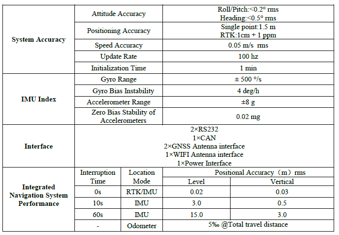
Performance Index
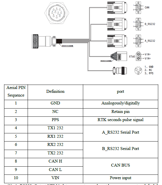
Data Line Interface Definition